

| << Chapter < Page | Chapter >> Page > |
1. The World
From this picture we can deduct that the earth is round. A round map of the earth is called a globe.
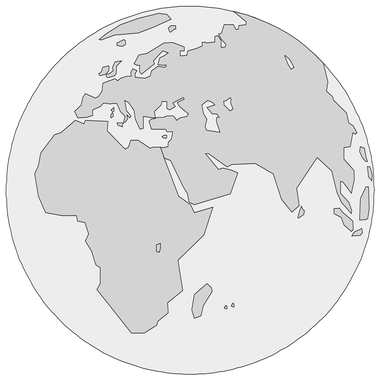
Have you ever tried to cut open and flatten a deflated ball? That is why most world maps portray the earth as “flat”.
2. Africa (my continent)


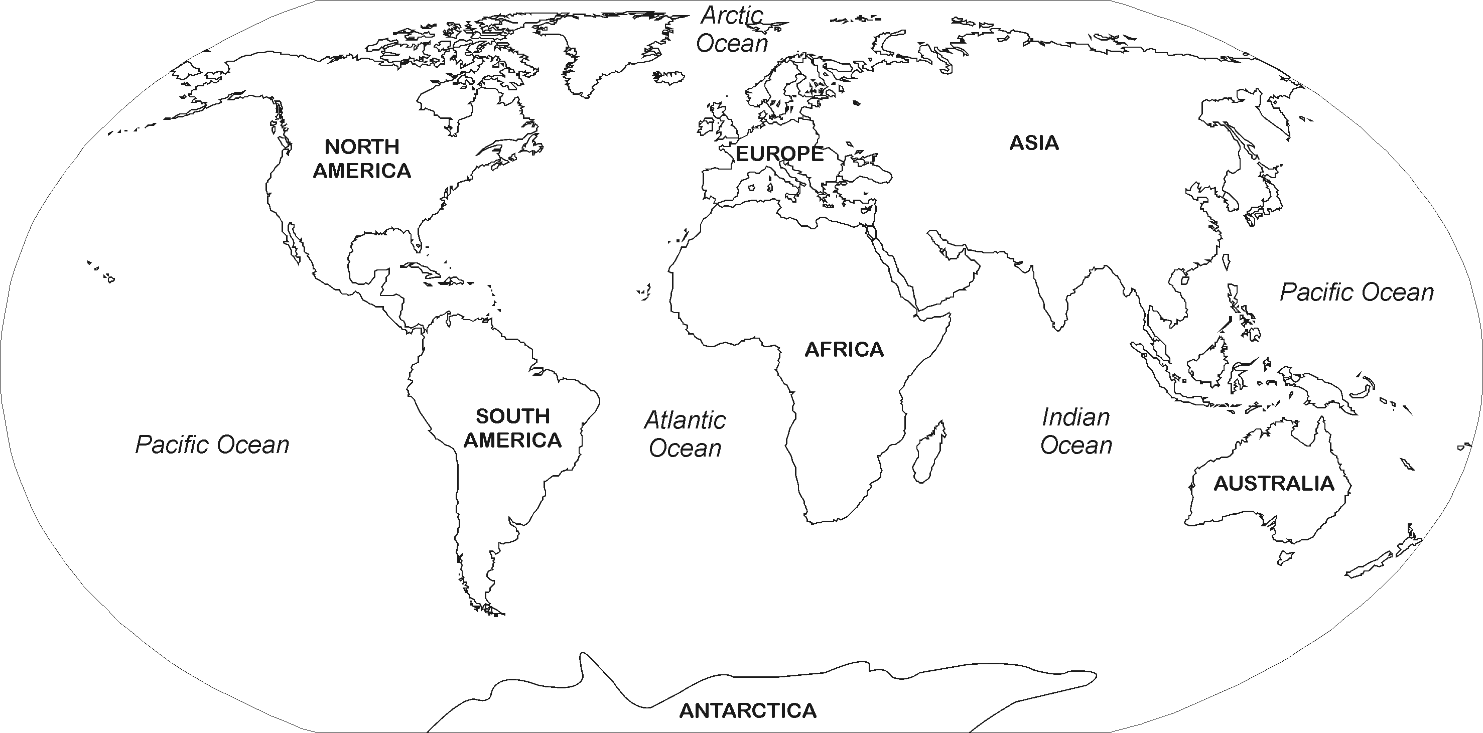
Study the map of the world on the previous page and answer the questions.
1. How many continents are there? …………………………………………
2. Which continent is the largest? ……………………………………………
3. Which continent is the smallest?……….……………………………………
4. Which ocean is found between Africa and South America?…………………
Which ocean is found between South America and Australia?
Colour in all the countries on the African continent beginning with an “N” in brown.
1. Colour your country (South Africa) red.
2. Write down the names of the countries that border on South Africa.
A country that borders on another country is called a neighbouring country .
3. South Africa (My land)
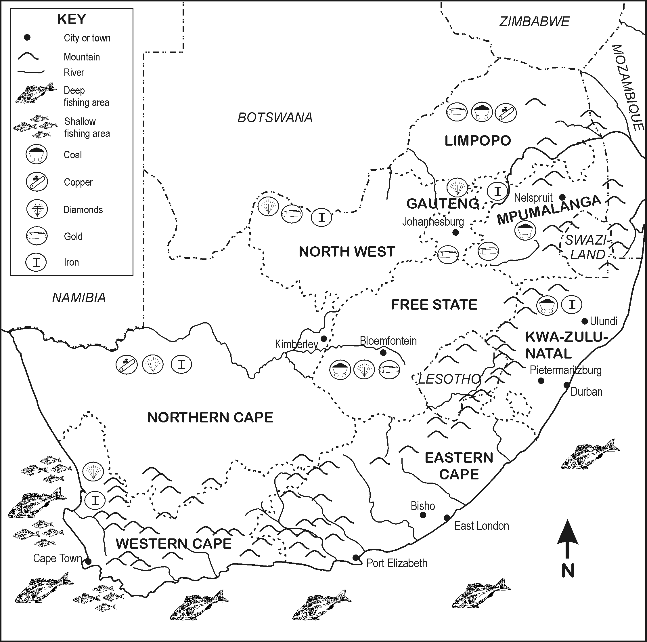
Within the borders of a country there are other borders that divide the country into provinces.
Look carefully at the map key of South Africa and answer the following questions:
1. Which big mountain range do we find in Kwazulu-Natal?
2. Name three minerals that are mined in the Northern Cape.
3. Which province is the farthest north?
4. Which river on the northern border of the Northern Cape flows into the Atlantic Ocean?
5. In which ocean will you be swimming when holidaying in Durban?
6. Which province is the smallest?
7. In which province are you when you are on a holiday in Port Elizabeth?
Your educator will hang a wall map of the world in the classroom. Listen to the world news every day and read newspapers. Bring geography articles to class and let your educator indicate with a pin on the wall map on which continent the events occurred. Discuss them and give your own opinion.
TRY TO CONTINUE WITH THIS ASSIGNMENT UNTIL THE END OF THE YEAR.
The learner will be able to use enquiry skills to investigate geographical and
environmental concepts and processes.
We know this when the learner:
1.5 identifies important political boundaries and key human and physical features on large-scale maps [works with sources].
4. Atlantic
2. Namibia, Botswana, Zimbabwe, Mozambique
8. E – no harbour
Notification Switch
Would you like to follow the 'Geography grade 4' conversation and receive update notifications?

|
|

|
|

|
|
|
|

|
|

|
|

|
|
|
|
|
|

|