

| << Chapter < Page | Chapter >> Page > |
The big difference between a photograph and a map is that a map represents a vertical “plan” of a region, while a photograph presents a realistic image.
The ordinary photographs with which we are acquainted are taken with a camera that is held in the horizontal position.
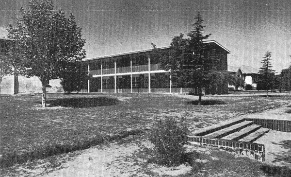
Objects that are close to the camera look large and those that are further away seem smaller. Objects in the foreground also obscure information regarding what is behind them. This hidden area is known as the hidden ground. What happens behind the behind the double-storey building is unknown to us.
These photographs cannot be used for information when we draw maps. A special kind of aerial photograph is used for the drawing of maps. Such photographs are taken vertically, i.e. by means of a camera that is attached to a special aeroplane in such a way that it points down towards the earth.
Study a vertical aerial photograph of Pietermaritzburg. The 1:50 000 map and the aerial photograph show the same area. You will therefore be able to identify the objects that are the same on the photograph and the map.
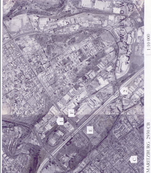
Figure 1
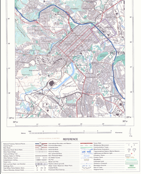
Figure 2
Example
A technical college will be found on the map at 29º35’30”S; 30º23’43”E.On the aerial photo the position of the technical college is marked S .
By comparing the features of the card with those of the aerial photograph, may other characteristics will be recognisable.
Use a topographic map and aerial photo of Pietermaritzburg and answer the following questions by circling the letter of the correct answer.
1. The point F on the aerial photo is the
a) national road
b) dirt road
c) railway
| Learning Outcomes(LOs) |
| LO 1 |
| Geographical EnquiryThe learner will be able to use enquiry skills to investigate geographical and environmental concepts and processes. |
| Assessment Standards(ASs) |
| We know this when the learner: |
|
|
|
|
ACTIVITY:
2. If the residential area of Willowtown were to develop, it will develop to the
a) south
b) east
c) west
3. The most important freeway on this map is the
a) N6
b) N3
c) N2
4. The phenomenon marked E on the aerial photo is
a) water tower
b) athletic field
c) cricket field
5. The object marked with a 2 is a
a) hiking trail
b) bridge
c) river
6. The object marked with a C is a
a) factory
b) police station
c) residential home
7. The object marked with a I is a
a) water tower
b) golf course
c) silo
Notification Switch
Would you like to follow the 'Geography grade 8' conversation and receive update notifications?

|
|

|
|

|
|

|
|

|
|

|
|

|
|

|
|

|
|

|